Rock Creek
1.5 Miles above Steep Creek to 3.5 Miles Below Steep Creek
Class: 4(5)
Length: 5 miles
Crafts: Kayaks
Season: Rainy
Rock Creek is a great run located conveniently close to Portland. Much smaller than the Wind River just to the west, Rock Creek offers a great intermediate run with several tougher rapids and a couple big waterfalls. At low flows there are ample eddies and most of the rapids are rocky. Hold onto your helmet at high flows as eddies disappear and the rapids develop quite some push. Great fun but be careful!
River Description(Kayak/Raft)
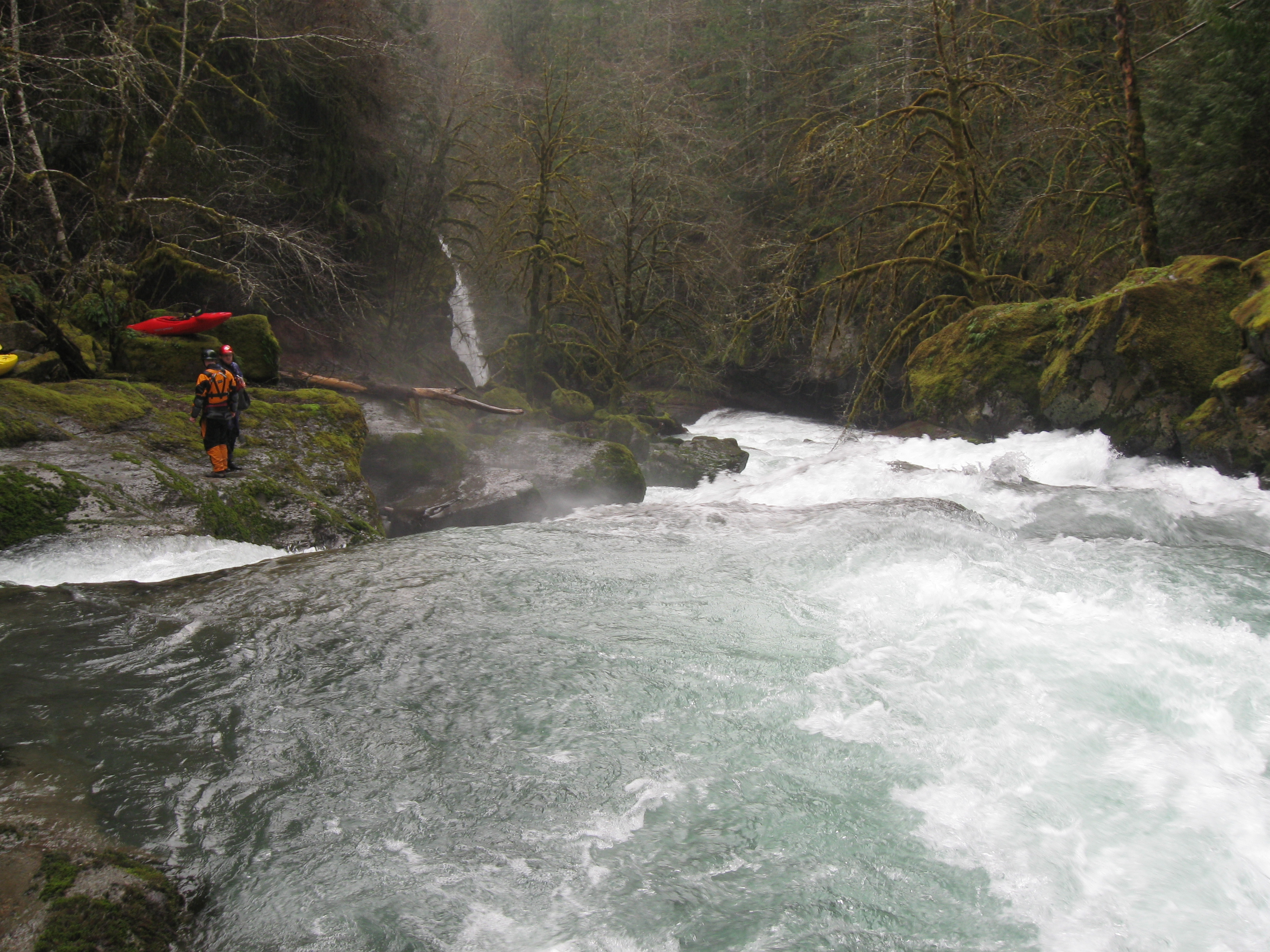
Immediately below the put-in at the road bridge the river contains some small boulder gardens and usually some logs to portage. Shortly though, the river consolidates into some fun ledge slides and small drops. About 1 mile from the bridge the river drops around a sharp right turn and enters a small gorge with an 8-foot ledge at the head of the gorge. This ledge is very difficult to scout from the river and is usually run by boofing down the middle. Shortly after this scenic gorge boaters reach Heaven and Hell, a nasty 10-foot drop which is followed immediately by a sloping 25-foot waterfall. Scout/portage both these drops on the left. There are several fun seal launches back to the river if boaters decide to portage these drops.
After some fun boulder gardens below the next road bridge the river slows for a mile or so before picking up again. Be careful here as just below a fun boulder garden with a riverwide hole at the bottom is Three Swim Falls, a very difficult 15-foot waterfall which drops into a narrow crack with undercuts. The eddy on the left above the falls is small and can be difficult to catch at higher flows so be cautious. The portage is along a broad rock shelf on the left. It is possible to putin just below the falls and run the steep boulder garden below or continue along the shelf to a good putin below the end of the boulder garden. More fun rapids continue all the way to the take-out including a great series of sliding ledges about 0.25 miles from the end of the run.
Hazards
Heaven and Hell and Three Swim Falls can be portaged on the left without too much difficulty. The final eddy above Three Swim Falls is small, particularly at higher flow but there are a couple small eddies earlier on the left which can be less stressful the first time down.
View Rock Creek, WA in a larger map
How to get there
Take-out (GPS: 45.72399, -121.93426)
From the west end of Stevenson take Rock Creek Drive east 0.6 miles to Ryan Allen Drive. Turn right and follow Ryan Allen Drive 0.5 miles to Red Bluff. Turn left and travel about 2.3 miles to a road on the right that leads down to the river. This is the take-out.
Put-in (GPS: 45.75608, -122.01003)
To reach the put-in, return to the main road and turn right. The put-in is at the 2nd road bridge. An alternate put-in is at the first road bridge.
Gauge
There currently is no online gauge for Rock Creek but it has a broad window of acceptable levels and correlates pretty well with other creeks in the area. Generally, the EF Lewis water level will get you in the ball park. I look for 1500-2500cfs in the EF Lewis for an acceptable level in Rock Creek.
Once at the river there is a stick gauge a couple miles below the take-out at the Ryan Allen Dr. bridge. It is right on the way to the put-in so can be checked easily.
Once at the take-out bridge the level can be checked again by looking upstream at the last rapid. There should be water flowing through the small bushes on the mid-stream gravel bar for a fun level. The water level can also be checked on the way upstream at several places including the bridge at Steep Creek, Heaven and Hell waterfall, and about a half mile below the put-in where the road comes right next to the creek.
More Info
Check out Jason's description of this run for additional info and photos.
Also, Jacob's description on Into the Outside.