Roaring River
4.9 miles above Clackamas River to Clackamas River
Class: 4-4+
Length: 4.9 miles
Crafts: Kayaks
Season: Rainy/Snowmelt
The Roaring River watershed is one of the last uncut, roadless areas in the Clackamas drainage. The view from the rim of the rugged canyon is one of the best in the area. The scenery is excellent throughout the run with old growth trees along the banks and rugged rock walls. The rapids are classic boulder gardens with some fun bedrock slides thrown in for variety. The upper section has a great 25 ft. waterfall.
River Description(Kayak/Raft)
Roaring River doesn't make it easy for boaters. The shuttle is about 45 minutes each way and access to the put-in requires a 3 mile hike down into the canyon. Some years the river has a large amount of wood and at high water a couple of the rapids have very unforgiving holes. Having said all that, Roaring River has some of the best Class 4 rapids in the Clackamas drainage and really is worth all the trouble.
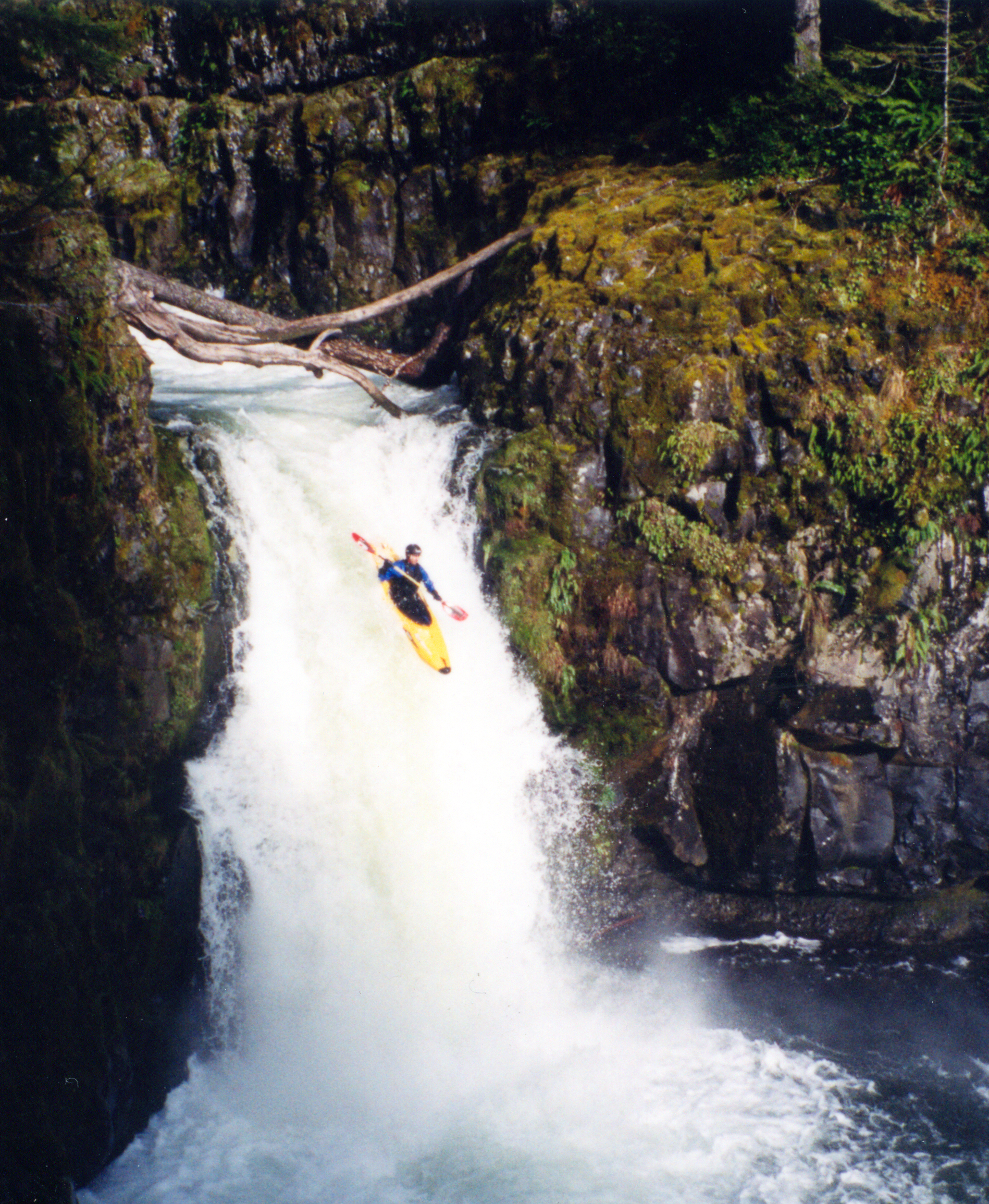
If you've found the put-in trailhead, prepare to shoulder your boat for a 60-90 minute downhill hike to the river. The trail has some good views and some nice forest as it drops steeply down to the river. The rapids start right from the beginning with some Class 3 boulder gardens with a fair amount of wood along the banks and above the river. If you are lucky to have a good water level you should be able to avoid portaging in this section but be careful as the wood shifts around a lot up here. You'll know you are getting to the falls when the river begins to consolidate and a distinctive bedrock ledge appears. Scout the hole at the base of the biggest ledge as it can get brutal at some water levels. Next stop, Perrywinkle Falls. This 25 ft. falls is pretty straight-forward but beware the big hit at the bottom. I missed my boof the first time I ran it, went deep, and nearly ripped my shoulder out its socket by not letting go of my paddle. Big fun, though. The falls can be portaged on the right by traversing the slope and then heading down a gully to the pool at the base of the falls or you can do a "throw and go".
The section below the falls is where most of the good rapids are. The gradient picks up considerably and the rocks get bigger; making for some exciting rapids. Although there is usually no shortage of eddies, the rapids only let off in a few places so it isn't a good place to get separated from gear. Pretty shortly below the falls is an obvious horizon line on a sharp right-hand bend. You'll see a bunch of wood piled up on the left bank. Scout on the right and see if you want to run this tricky ledge drop. Just below the first part of this rapid is an excellent, steep boulder garden. Probably my favorite on the whole run. If you don't want to run the boulder garden you can portage both parts of the rapid on the right.
Below this rapid there are many, many good Class 3+-4 rapids with excellent scenery. Be on your toes for the odd piece of wood here and there. Once you hit a long gradual bedrock slide, eddy out quickly on the left. Just downstream is a series of small ledges ending in a very retentive hole. This hole has been known to circulate swimmers for a long time so be sure to set a rope for safety. The entire rapid can be easily scouted/portaged on the left. More great rapids continue from here to the end with some really excellent ledge drops in the last 1/2 mile. When you hit the Clackamas River it will be hard to wipe the grin off your face!
Hazards
The first time I ran Roaring River there were probably 6 portages. Currently, I've been able to do it with 2-4 portages depending on where you put in. None of the portages are that hard but there is always the possibility of new wood so be on your toes. Watch out for some sticky holes at high water; particularly in the last mile or so.
If you do get into trouble in the canyon there is an animal trail that follows the river on the left for the last 2 miles. Getting to the takeout is the only reasonable option of getting out of the canyon.
View Roaring River in a larger map
How to get there
Take-out (GPS: 45o09.516'N, 122o07.058'W)
The take-out is at the Hwy. 224 bridge over Roaring River where it joins the Clackamas River.
Put-in
Although it is a long drive to either the lower or upper put-in trail, both are fairly straight-forward if you pay attention. Turn onto Forest Road 4610 6.4 miles east of Estacada (across the highway from Promontory Park). Travel about 7 miles on 4610 and you will be at a distinct split in the road.
Upper Put-in (GPS: 45.211747°, -122.065497°)
To reach the upper put-in, turn left at the split (staying on 4610) and travel about another .75 miles and turn right on Abbott Rd. Look for a small quarry on the left and the old Lookout Springs Campground entrance on the right after about 5.25 miles. Make sure you bring a road and trail map just in case. If you are trying to run the upper section in winter you will most likely hit snow about a 1/2 mile from the trailhead. The trail is to your left about 10 yards from the entrance of the campground. Follow the trail about 3 miles down to Roaring River. Be sure to stay left at the first trail junction or you will end up at Huxley Lake and never make it to the river.
Lower Put-in
To reach the lower put-in, stay straight at the split in the road which is 4611. There are two road junctions to look for. Stay straight at the first 2-way split. Turn right at the major 3-way split. Stay on this road all the way to the trailhead. The road gets really bad about 1 mile from the trailhead. High clearance makes the drive less stressful.
Gauge
There is a stick gauge a hundred yards upstream of the take-out bridge on river-right. But, in general, if you are comfortable running the rapid just upstream of the Hwy. 224 bridge then the rest of the run should be ok. There is a trail going upstream from Roaring River campground with views of several rapids that can give boaters a feel for the nature of the run.
It is really hard to judge flow from the main Clackamas River. I've had medium water at 1300cfs during a flash rain event in August and low water at 3000cfs in winter. Generally you'll want at least 2500cfs on the Clackamas River but pay attention to how hard it is raining. If similar size creeks in the area (Rock Cr., Wa, NF Washougal, etc. are running than Roaring River probably is as well.
More Info
Check out Jason's description of this run.