Clackamas River-Cazadero
1 mile above locked gate to locked gate
Class: 3-4(5)
Length: 1 mile
Crafts: Kayaks
Season: year-round
Little known to many paddlers as they drive the highway up to the more popular sections of the Clackamas, tucked away between 3 dams and de-watered much of the year, lies the Cazadero stretch of the Clackamas. This short stretch of river is a bittersweet reminder of what lies buried beneath 3 reservoirs today but still offers a short, sweet set of rapids when water levels cooperate.
River Description(Kayak/Raft)
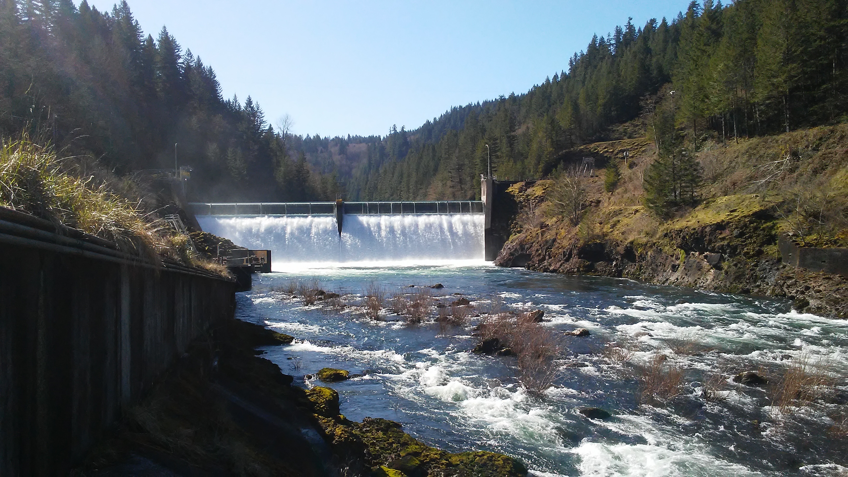
The Cazadero stretch of the Clackamas is a short section of river starting at the base of the Faraday diversion dam and ending in the slack waters of the River Mill reservoir. It has 5-6 rapids depending on where you take-out and which lines you run. The biggest rapids are steep which makes boat scouting challenging but the lines are mostly forgiving and there are pools at the bottom of each rapid.
The biggest and most consequential rapid is the 4th rapid, Island, where the river splits around, you guessed it, an island. The right side is one long, steep rapid that pushes into an undercut wall on the right at the bottom, Class 5. The left side of the island can be separated into 3 distinct drops. The first is a congested boulder jumble similar to Revenue Bridge Rapid on the Sandy Gorge. There are several clean lines depending on the flow but they can be difficult to scout from the left bank. There is a good line on the far left but at lower flows it can be tricky to get to it. The remaining two drops on the left side are straight-forward waves and holes similar to Toilet Bowl on the Upper Clackamas, fun.
After Island, the gradient starts to taper off. There are two more rapids if you are running all the way down to the next reservoir but the better option is to find the take-out trail one rapid below Island and head back up to where you parked. From there you can decide to do another lap or call it a day.
Hazards
The biggest hazard on the river is the undercut wall at the bottom of the right side of Island Rapid. The line and hazard can be scouted from the island in the middle of the river but it takes some work.
At high flows, above 3000 cfs, several of the rapids have large holes to avoid or punch. There are, however, still good recovery pools in between the rapids.
The water is very cold.
View Clackamas River-Cazadero in a larger map
How to get there
Take-out (GPS: 45.26581, -122.30611)
To reach the take-out, travel east of Estacada on Hwy. 224 about 1.1 miles and turn right at the sign for the West Side Hydro Project and E. Faraday Road. Drive to the locked gate at the end of the road.
From the river, there is currently a restriction on boating down past the Faraday Powerhouse construction so find the take-out trail on the right at the second warning sign hanging over the river.
Put-in (GPS: 45.25411, -122.29697)
Hike upstream along the road about .9 miles to the junction with a spur road on the right that goes down to the river. At the end of this road you can decide whether you want to climb down to the bottom of the first rapid to put-in or traverse upstream another 100 meters and lower down the sloping wall to the river.
Gauge
Water flow in this section is controlled by how much water is diverted at the Faraday Diversion Dam. During much of the year, only a base fish-flow of 100-300 cfs is left in the riverbed and the rest flows through the Faraday Powerhouse downstream. In winter, high flows will exceed the diversion capacity of the dam (about 4500cfs), resulting in good water flows for paddling. So a flow of 5500 cfs on the upper river would result in about 1000 cfs in this section, a decent low flow.
As of 2020, construction at the Faraday Powerhouse means the Faraday diversion dam is not in use and this section of river has the same flow as the Upper Clackamas.
More Info