Canyon Creek
Owl Creek to South Santiam
Class: 5
Length: 7.5 miles
Crafts: Kayaks
Season: Rainy
Canyon Creek is one of the few true class 5 creeks in Oregon. Steep, continuous drops with undercuts and log hazards make Canyon Creek an excellent run for expert boaters. Unstable geology also makes Canyon Creek one of the more dynamic creeks in Oregon with rapid configurations changing every few years after big flood events. Only a couple of the big rapids can be scouted beforehand so consider carefully before committing to the run.
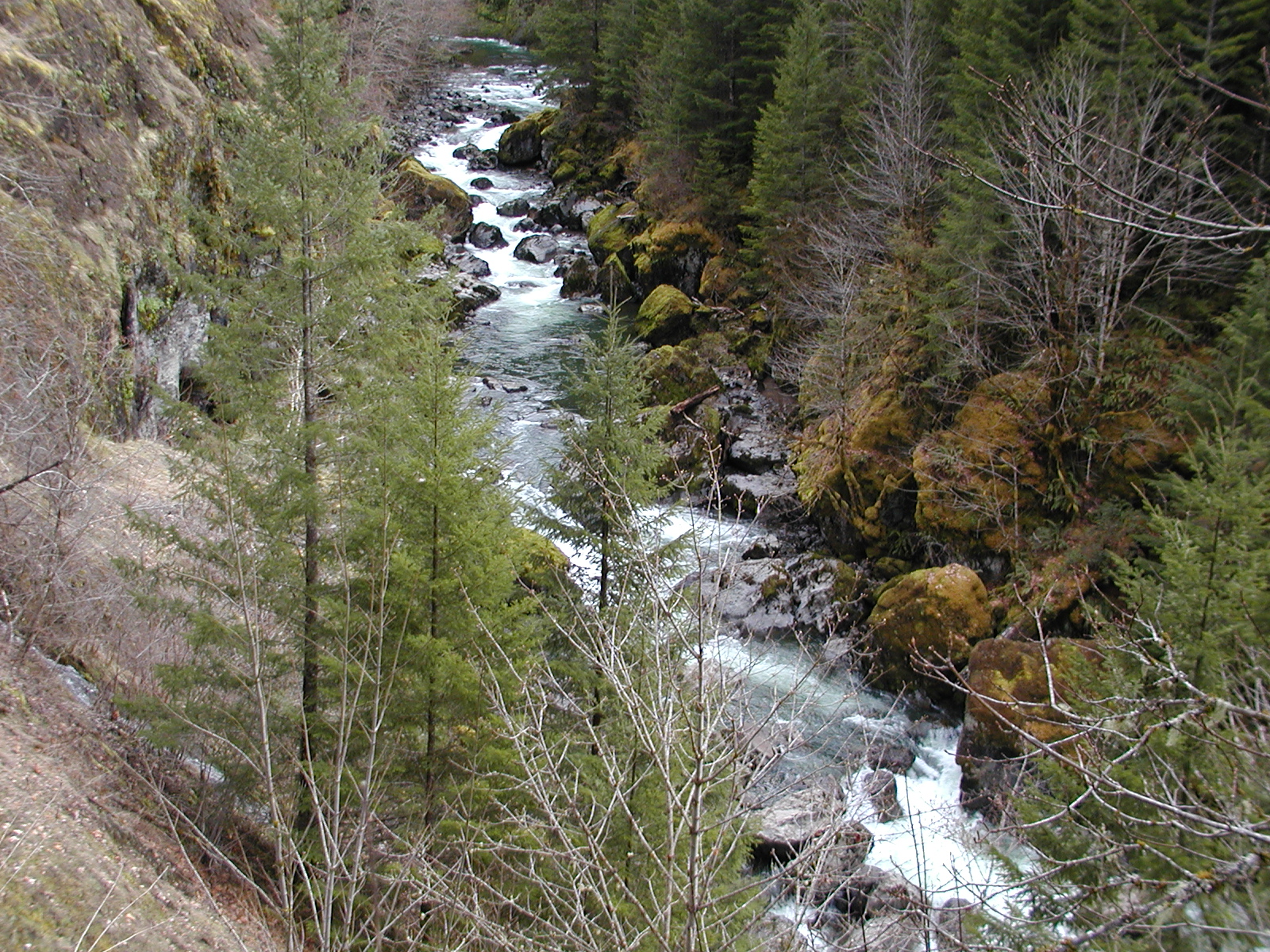
Looking down into Terminator Rapid
River Description(Kayak/Raft)
The first 0.5 miles of the run is flat with several logs and gives no indication of the intense rapids found farther downstream. The first major rapid, Chocolate Chips, consists of a tricky ledge drop at the top and a narrow slot into a hole at the bottom. Scout/portage on the right. Another 100 yards downstream is the beginning of Chicken Little, a long, complex boulder garden that often contains wood. Several sharp ledges and steep boulder gardens follow Chicken Little until boaters reach Terminator. Boaters must run the narrow slot on the right in order to avoid being pushed into a dangerous sieve on the left. Scout/portage on the right. Immediately below Terminator is a very steep boulder garden, Day of Judgement. Most boaters run Day of Judgement by boofing down the middle in order to avoid sieves on either side of the rapid. Scout/portage on the right. More steep rapids continue for another mile before the gradient decreases and the rapids become smaller and less frequent.
Be on the lookout for a steep drop near the middle of this flatter section. Osprey Rapid can be scouted or portaged on the right. The mile above the take-out contains many fun class 3-4 rapids set in a beautiful canyon and is a great way to end the day after the challenging rapids upstream.
Hazards
Unstable geology can change rapids and deposit dangerous wood in many of the rapids. Large hydraulics develop at high water making several of the harder rapids very dangerous.
How to get there
View Canyon Creek in a larger map
Take-out (GPS:44.396725°, -122.447559°)
US 20, east of Albany and Sweet Home, follows the South Santiam River. 1.8 miles east of Cascadia State Park US 20 crosses Canyon Creek. Turn north(left) on a short spur road that leads to the confluence of Canyon Creek with the South Santiam River, the take-out.
Put-in (GPS: 44.333922, -122.361805)
For the put-in, follow Canyon Creek Road (NFD 2022) along Canyon Creek for 7 miles to a fork, bear right, and put in at the bridge.
Gauge
None exists. A flow of 1,200-2,000 cfs on the South Santiam River at Cascadia means adequate flow. Also, Canyon Creek generally has more water than Wiley Creek and less water than Blue River. All of these gauges are currently available via the internet (South Santiam at Cascadia, Wiley Creek Near Foster, and Blue River below Tidbits Creek.
More Info
Check out Jason't description of this run.
Also a trip report on Nate's blog.
And additional info on AW site here